About Nepal
Wedged between the high Himalaya and the steamy Indian plains, Nepal is a land of snow peaks and Sherpas, yaks and yetis, monasteries and mantras.
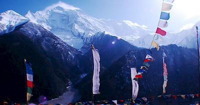
Mountain Highs
The Nepal Himalaya is the ultimate goal for most mountain lovers. Some of the Himalaya’s most iconic and accessible hiking is on offer here, with rugged trails to Everest, the Annapurnas and beyond, and most trekking areas escaped with only minor damage in the 2015 earthquake. Nowhere else can you trek for days in incredible mountain scenery, secure in the knowledge that a hot meal, cosy lodge and warm slice of apple pie await you at the end of the day.
Then there's the adrenaline kick of rafting a roaring Nepali river or bungee jumping into a bottomless Himalayan gorge. Canyoning, climbing, kayaking, paragliding and mountain biking all offer a rush against the backdrop of some of the world’s most dramatic landscapes.
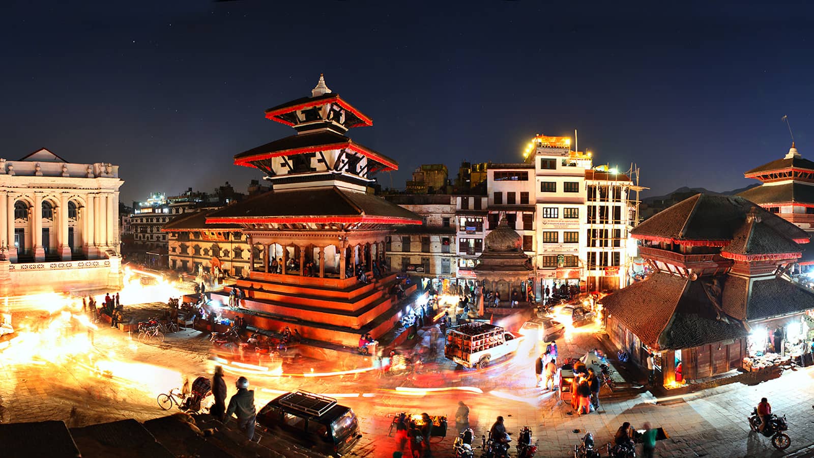
Medieval Cities & Sacred Sites
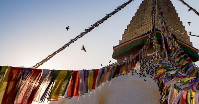
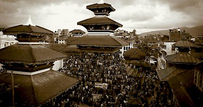
Other travellers prefer to see Nepal at a more refined pace, admiring the peaks over a gin and tonic from a Himalayan viewpoint, strolling through the medieval city squares of Kathmandu, Patan and Bhaktapur, and joining Tibetan Buddhist pilgrims on a spiritual stroll around centuries-old stupas and monasteries. Even after the 2015 earthquake, Nepal remains the cultural powerhouse of the Himalaya; the Kathmandu Valley offers an unrivalled collection of world-class palaces, hidden backstreet shrines and sublime temple art.
Travel Nirvana
There are few countries in the world that are as well set up for independent travel as Nepal. Wandering the trekking shops, bakeries and pizzerias of Thamel and Pokhara, it’s easy to feel that you have somehow landed in a kind of backpacker Disneyland. Out in the countryside lies a quite different Nepal, where traditional mountain life continues at a slower pace, and a million potential adventures glimmer on the mountain horizons.
Many people have spent a lifetime exploring the mountain trails of the Himalaya and the atmospheric temple towns of the Middle Hills, and they still keep coming back for more. The biggest problem you might face in Nepal is just how to fit everything in.
Why I Love Nepal?
If, like me, you get your highs from pristine mountain views and the sense of perspective that a Himalayan journey offers, then you are going to like Nepal. But if, also like me, you've always secretly wished that your mountain wilderness came with a warm slice of apple pie instead of a soggy tent, then you will simply love this place. My favourite thing about Nepal ? There's always another adventure. Done Annapurna? Try the Gokyo Valley. Done Gokyo? Try a 6000m trekking peak. It's adventure heaven, with an espresso on the side.
Jungle Adventures
Further south lie Nepal’s wild and woolly national parks, where nature buffs scan the treetops for exotic bird species and comb the jungles for rhinos and tigers from the backs of lumbering Indian elephants. Choose from a luxury safari lodge in central Chitwan or go exploring on a wilder trip to remote Bardia or Koshi Tappu. Whether you cross the country by mountain bike, motorbike, raft or tourist bus, Nepal offers an astonishingly diverse array of attractions and landscapes.
By Bradley Mayhew, for Loney Planet.
Nepal, officially the Federal Democratic Republic of Nepal, is a Sovereign state located in South Asia. With an area of 147,181 square kilometres (56,827 sq mi) and a population of approximately 27 million, Nepal is the world's 93rd largest country by area and the 41st most populous country. It is a landlocked country located along the Himalayas and bordered to the north by China and to the south, east, and west by India. Nepal is separated from Bangladesh by the narrow Indian Siliguri Corridor and from Bhutan by the Indian state of Sikkim. Kathmandu is the nation's capital city and largest metropolis.
The mountainous north of Nepal has eight of the world's ten tallest mountains, including the highest point on Earth, Mount Everest (Himalayas Mountains). More than 250 peaks over 20,000 ft (6,096 m) above sea level are located in Nepal.The southern Madhesh region is fertile and humid.
Hinduism is practiced by about 81.3% of Nepalis, the highest percentage of any country. Buddhism is linked historically with Nepal and is practiced by 9% of its people, followed by Islam at 4.4%, Kiratism 3.1%, Christianity 1.4%, and animism 0.4%. A large portion of the population, especially in the hill region, may identify themselves as both Hindu and Buddhist, which can be attributed to the syncretic nature of both faiths in Nepal.
A monarchy throughout most of its history, Nepal was ruled by the Shah dynasty of kings from 1768—when Prithvi Narayan Shah unified its many small kingdoms—until 2008. A decade-long Civil War involving the Communist Party of Nepal (Maoist), followed by weeks of mass protests by all major political parties, led to the 12-point agreement of 22 November 2005. The ensuing elections for the 1st Nepali Constituent Assembly on 28 May 2008 overwhelmingly favored the abolition of the monarchy and the establishment of a federal multiparty representative democratic republic. Despite continuing political challenges, this framework remained in place, with the 2nd Nepali Constituent Assembly elected in 2013 in an effort to create a new constitution.
On September 20, 2015, a new constitution was announced by President Ram Baran Yadav in the Constituent Assembly. The Constituent Assembly was transformed into a legislative parliament. The new constitution established Nepal as a federal democratic country by making seven unnamed states.
Nepal is a developing country with a low income economy, ranking 145th of 187 countries on the Human Development Index (HDI) in 2014. It continues to struggle with high levels of hunger and poverty. Despite these challenges, Nepal has been making steady progress, with the government making a commitment to graduate the nation from least developed country status by 2022.
Geography of Nepal
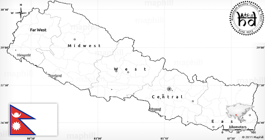
Nepal is of roughly trapezoidal shape, 800 kilometres (497 mi) long and 200 kilometres (124 mi) wide, with an area of 147,181 km2 (56,827 sq mi). It lies between latitudes 26° and 31°N, and longitudes 80° and 89°E.
Nepal is commonly divided into three physiographic areas: Mountain, Hill and Terai. These ecological belts run east-west and are vertically intersected by Nepal's major, north to south flowing river systems.
The southern lowland plains or Terai bordering India are part of the northern rim of the Indo-Gangetic Plain. They were formed and are fed by three major Himalayan rivers: the Kosi, the Narayani, and the Karnali as well as smaller rivers rising below the permanent snowline. This region has a subtropical to tropical climate. The outermost range of foothills called Sivalik Hills or Churia Range cresting at 700 to 1,000 metres (2,297 to 3,281 ft) marks the limit of the Gangetic Plain, however broad, low valleys called Inner Tarai Valleys (Bhitri Tarai Uptyaka) lie north of these foothills in several places.
The Hill Region (Pahad) abuts the mountains and varies from 800 to 4,000 metres (2,625 to 13,123 ft) in altitude with progression from subtropical climates below 1,200 metres (3,937 ft) to alpine climates above 3,600 metres (11,811 ft). The Lower Himalayan Range reaching 1,500 to 3,000 metres (4,921 to 9,843 ft) is the southern limit of this region, with subtropical river valleys and "hills" alternating to the north of this range. Population density is high in valleys but notably less above 2,000 metres (6,562 ft) and very low above 2,500 metres (8,202 ft) where snow occasionally falls in winter.
The Mountain Region (Himal), situated in the Great Himalayan Range, makes up the northern part of Nepal. It contains the highest elevations in the world including 8,848 metres (29,029 ft) height Mount Everest (Sagarmāthā in Nepali) on the border with China. Seven other of the world's "eight-thousanders" are in Nepal or on its border with China: Lhotse, Makalu, Cho Oyu, Kangchenjunga, Dhaulagiri, Annapurna and Manaslu.
Nepal's Climate
Nepal has five climatic zones, broadly corresponding to the altitudes. The tropical and subtropical zones lie below 1,200 metres (3,937 ft), the temperate zone 1,200 to 2,400 metres (3,937 to 7,874 ft), the cold zone 2,400 to 3,600 metres (7,874 to 11,811 ft), the subarctic zone 3,600 to 4,400 metres (11,811 to 14,436 ft), and the Arctic zone above 4,400 metres (14,436 ft).
Nepal experiences five seasons: summer, monsoon, autumn, winter and spring. The Himalaya blocks cold winds from Central Asia in the winter and forms the northern limit of the monsoon wind patterns. In a land once thickly forested, deforestation is a major problem in all regions, with resulting erosion and degradation of ecosystems.
Nepal is popular for mountaineering, having some of the highest and most challenging mountains in the world, including Mount Everest. Technically, the south-east ridge on the Nepali side of the mountain is easier to climb; so, most climbers prefer to trek to Everest through Nepal.
Environment of Nepal
The dramatic differences in elevation found in Nepal result in a variety of biomes, from tropical savannas along the Indian border, to subtropical broadleaf and coniferous forests in the Hill Region, to temperate broadleaf and coniferous forests on the slopes of the Himalaya, to montane grasslands and shrublands and rock and ice at the highest elevations.
At the lowest elevations is the Terai-Duar savanna and grasslands ecoregion. These form a mosaic with the Himalayan subtropical broadleaf forests, which occur from 500 to 1,000 metres (1,600 to 3,300 ft) and include the Inner Terai Valleys. Himalayan subtropical pine forests occur between 1,000 and 2,000 metres (3,300 and 6,600 ft).
Above these elevations, the biogeography of Nepal is generally divided from east to west by the Gandaki River. Ecoregions to the east tend to receive more precipitation and to be more species-rich. Those to the west are drier with fewer species.
From 1,500 to 3,000 metres (4,900 to 9,800 ft), are temperate broadleaf forests: the eastern and western Himalayan broadleaf forests. From 3,000 to 4,000 metres (9,800 to 13,100 ft) are the eastern and western Himalayan subalpine conifer forests. To 5,500 metres (18,000 ft) are the eastern and western Himalayan alpine shrub and meadows.
Source: Wikipedia